2.1. ENUNCIADO ciudades-formas. ASSIGNMENT CITIES-FORMS
Creada el 21 de Septiembre de 2024 a las 10:26 por dacama - abarcaProyecto: Urban Games 2024
Tema: 2.1. aproximaciones. ciudades-formas | APPROACHES. CITIES-FORMS
Coordinadores:
abarca
dacama
falvarez
Valoración general
0/5 (0 votaciones)Valoración de coordinadores
0/5 (0 votaciones)Descripción
EntradaBlog
Entrada de Blog
[ESPAÑOL]
1. Valoración del emplazamiento y las formas de la ciudad
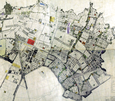
Cartografía y relieve de las singularidades topográficas y adaptaciones de la ciudad al sitio o emplazamiento y transformaciones del soporte geográfico. Accidentes y nuevos órdenes. Rasgos o referencias. Resaltar y destacar especialmente los lugares y detalles del relieve urbano de la ventana seleccionada comprendiendo su encaje en la situación geográfica general de la ciudad.
Este ejercicio no consiste en dibujar solo curvas de nivel y contornos de manzanas, sino en expresar la forma peculiar de adaptarse la ciudad a su relieve, modificándolo y aprovechando sus particularidades, orientación, rasantes, pendientes, pequeñas elevaciones, visuales…
El plano incluirá, a su vez, un análisis y dibujo en planta de las formas urbanas básicas (calles; plazas y parques; arquitecturas singulares) atendiendo geometría y espacialidad de una forma gráfica adecuada a sus dimensiones, carácter, usos, etc.
ENTREGA: Panel A2 horizontal. Realización A MANO a escala 1/5.000 de la ventana de trabajo (800x2400 m) en papel 48x16cm. En equipo.
2. MAQUETA
Se propone la elaboración en equipo-ciudad de 5 maquetas sobre 5 ventanas de 5 ciudades ejemplares del mundo.
Sobre la ventana seleccionada y encuadrada en el ejercicio anterior, cada equipo- ciudad (con estudiantes de todos los subgrupos ABCDE) desarrollará una maqueta a escala 1/1.000 de 800x2400m (3 sectores cuadrados de 800x800m, 1/2x1/2 milla).
Se estima que habrá entre 20-30 estudiantes en cada equipo-ciudad.
Esta actividad tiene la misión de ir acompañando el desarrollo de las diferentes unidades temáticas tratadas semanalmente, materializándolas físicamente en la maqueta a escala 1/1.000, además de mediante el proyecto, dibujo y los planos.
Esta actividad aporta además de una experiencia tridimensional de la ciudad, el reto complejo de organizarse y trabajar en grandes equipos.
La elección de los materiales y el sistema de elaboración es libre. Tan solo se sugiere que sea un instrumento de comprensión de los aspectos urbanos y arquitectónicos importantes y se entienda como una maqueta de trabajo en la que se permita su transformación para los proyectos que se planteen durante el taller.
ENTREGA: Dossier. Se describirá con fotografías, dibujos y texto todo el proceso de organización y elaboración de la maqueta, así como un reportaje FINAL específico de los aspectos urbanos y arquitectónicos más destacados de la misma.
[ENGLISH]
1. Assessing the siting and form of the city
Cartography and highlighting of the topographical singularities and adaptations of the city to the site or siting and transformations of the geographical base. Accidents and new layouts. Features or references. Highlight and emphasise the sites and details of the urban relief of the selected window, understanding how they fit into the general geographical situation of the city.
This exercise does not only consist of drawing level curves and outlines of blocks but of showing the particular way in which the city adapts to its topography, modifying it and taking advantage of its features, orientation, gradients, slopes, small elevations, visuals, etc.
The blueprint will include, in turn, an analysis and plan drawing of the basic urban forms (streets; squares and parks; singular architectures) taking into account geometry and spatiality in a graphic form appropriate to their dimensions, character, singular functions, etc.
DELIVERY: A2 horizontal panel. HAND drawn to scale 1/5.000 of the working window (800x2400 m) on 48x16cm paper, in team.
2. MODEL
Each city-team has to create a model for the given city, in its area or windows defined.
On the window selected and framed in class, each city team (with students from all ABCDE groups) will develop a 1/1000 scale model of 800x2400 meters (3 square sectors of 800x800 meters, approx. 1/2x1/2 mile).
It is expected that there will be between 20-30 students in each city team.
This activity has the purpose of accompanying the development of the different topics dealt with each week, delivering them physically in the 1/1,000 scale model, as well as through the project, drawing and plans.
In addition to a three-dimensional experience of the city, this activity provides the complex challenge of organising and working in large teams.
The choice of materials and the production technique is free. It is only suggested that it should be an instrument for understanding the important urban and architectural aspects and that it should be understood as a working model that allows its transformation for the projects that are proposed during the workshop.
DELIVERY: Dossier. The whole process of organisation and elaboration of the model will be described with photographs, drawings and text, as well as a specific FINAL report on the most outstanding urban and architectural aspects of the model.
Comentarios
Aún no hay comentarios para esta entrada. ¡Sé el primero!
Accede o regístrate para comentar y puntuar la entrada.