Revisión proyecto final
Creada el 12 de Enero de 2018 a las 16:57 por pakero - edloma96Proyecto: Urban Games 2017
Tema: Urban Game 10. PROYECTO FINAL
Coordinadores:
abarca
dacama
Valoración general
0/5 (0 votaciones)Valoración de coordinadores
0/5 (0 votaciones)Descripción
Panel
Comentarios
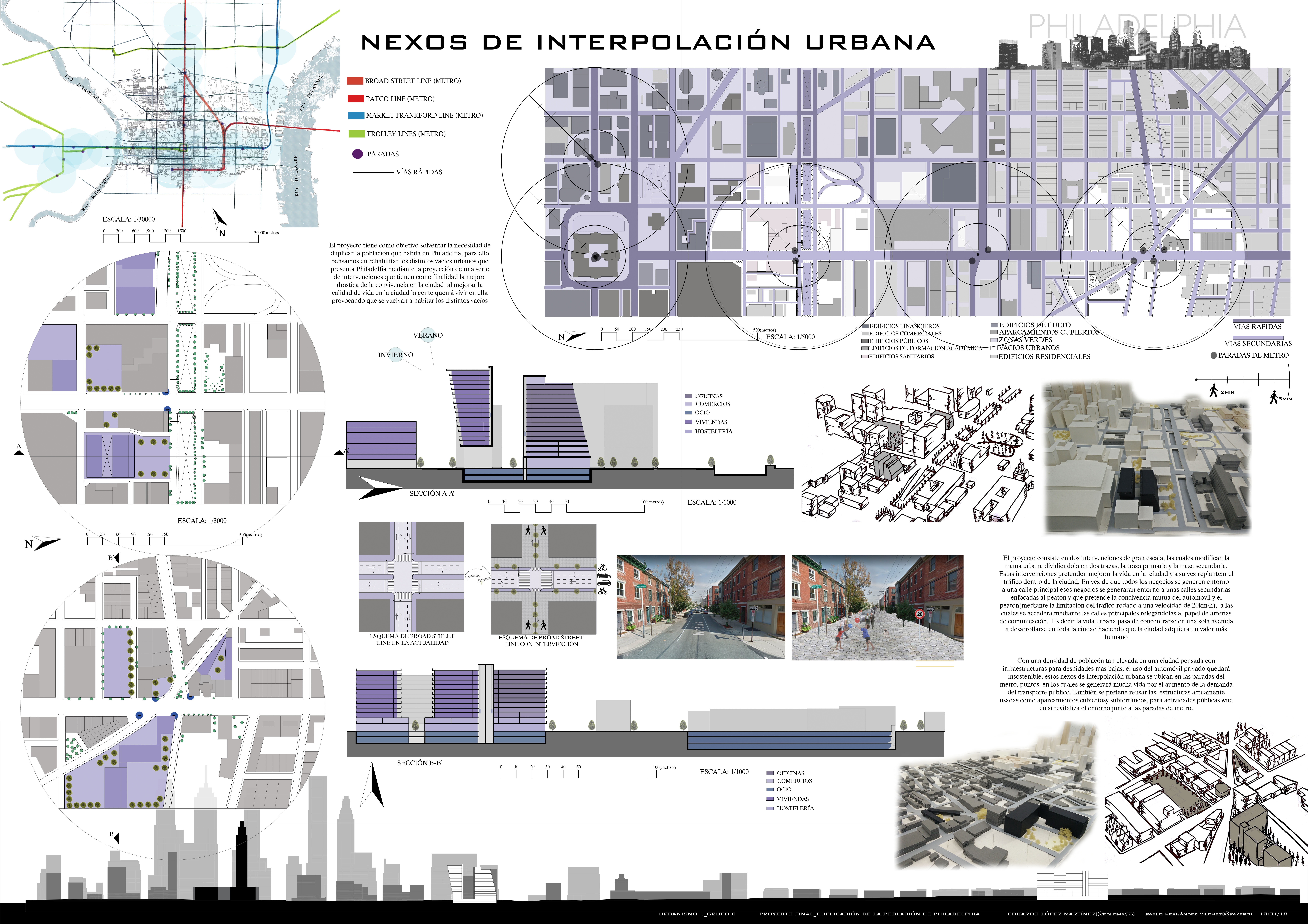
Firstly, dividing the streets by function will support the idea of decreasing traffic density. In Turkey, there is timetable for some touristic road that cars, buses and other vehicles can use them at some spesific time. Apart from that times they are belong just only for pedestrians. It is better to seperate bicycle and other vehicles because of the speed difference but when population growth seriously it is hard to create places for different functions. On the other point, it is useful using subway system connected with time and function. Because normally, we spend most of our times on transportation in big cities and this is a good point evaluating this time and this location for public activities. This can be helpful to improve to control city life such as gathering people on activities or public education or social manupulating. It can be related with pedestarian route that local people are using mostly. It can be divided as groups in a different way such as; youngs/adults/elderly, students/producers/comsumers etc. On the other hand, it is useful for building that you designed are located near subway points for people to work, to study, to live there. People can reach opportunity as the same reason that I was writing about.
Accede o regístrate para comentar y puntuar la entrada.

