Últimos comentarios realizados
It is a good point provide parking and sightseeing at the same time and also in so many place in the city creating from useless places to public places, with the green areas and also some observing point. I like observing ideas any of cities because it gives us live in other directions. Also for lighening is really important isues for loja, make the people safe and also make them doing their activities in the part of this places. I think lightening is the best point of this presentation.
I think the most important point is the conscious creation of spaces in which citizens can appropriate and give that sense of belonging that is normally lost in cities with these constructive magnitudes. The orher fact is that it is continues and it is consistent so it is not cut in some point.
It is good to divided functions in that way like in a different part of ages. We were studying in the same area and we were thinking about the same because philadephia was using different kind of people. In a funcionak way is students, residental, mixed etc. and the other way different ages, different aims. Design that we are thinking about has to provided both way but in proper area.
Presentation techniques and selection of color is affects important point for analysis. The topografy occurs its own way and shows us what can we do for this site. By the way it can be clear to show us for understanding the aim of analysis. There is so much gap in my imagination between site and the aim of analysis.
I think it is good to take consider in a different way of function but the colours or expresion way of idea make your presentation complicated. Maybe it could be nice if you did different maps for differents function or analises.
I think that your proposal of low desity works well with the rest of the block, because it generates a large space common to different types of people. The axes allows to green spaces and central plans. The space you give to parcel allows to getting sunlight well and for each part of block can ventilate well. The trees will control light and ventilation and also will create a new ambiance in the parcel. Maybe it coul be nice if you would have created more pssage from inside to outside.
Firstly, dividing the streets by function will support the idea of decreasing traffic density. In Turkey, there is timetable for some touristic road that cars, buses and other vehicles can use them at some spesific time. Apart from that times they are belong just only for pedestrians. It is better to seperate bicycle and other vehicles because of the speed difference but when population growth seriously it is hard to create places for different functions. On the other point, it is useful using subway system connected with time and function. Because normally, we spend most of our times on transportation in big cities and this is a good point evaluating this time and this location for public activities. This can be helpful to improve to control city life such as gathering people on activities or public education or social manupulating. It can be related with pedestarian route that local people are using mostly. It can be divided as groups in a different way such as; youngs/adults/elderly, students/producers/comsumers etc. On the other hand, it is useful for building that you designed are located near subway points for people to work, to study, to live there. People can reach opportunity as the same reason that I was writing about.
Últimos comentarios recibidos
El plano de los usos es bien representado pero para mi no es muy claro porque todo tiene color, así que no hay una diferenciación clara entre los usos y me confunde un poco. También la propuesta me parece muy interesante pero siempre me parece mal representada: no es inmediata la comprensión de la propuesta, solo se entiende donde quiereis trabajar. Al final buenas ideas pero falta de buena representación, también importante en un trabajo de urbanismo.
Los usos actuales de la ciudad están muy bien definidos en el plano pero no se diferencian muy bien los colores en la leyenda. La propuesta me parece muy buena, la idea de aumentar las zonas verdes y crear parkings subterráneos en esa zona en especial, pero en la presentación, en el plano, me falta un poco más de detalle.
La intervención queda bastante desligada sin un hilo que una las diferentes piezas.
La distribución de los bloques es innovadora y diferente, con un buen emplazamiento que explica la ubicación y da un panorama amplio del bloque!!
Esta muy bien la forma esquemática del plano pero no expresa que es cada elemento.
En mi opinion, las diferentes actividades de la ciudad son representadas de manera muy clara sobre este plano. Así, podemos distinguir fácilmente el tipo de actividad que domina en cada zona. Sin embargo, creo que las vias de acceso habrían debido ser representados y jerarquizados porque esto permite entender si se trata de una zona muy dinámica o más bien tranquila de la ciudad, y asi, leer mas concretamente su funcionamiento. También habría sido interesante de indicar las principales redes de transportes públicos.
El comentario anterior no pertenece a esta entrada. Disculpas.
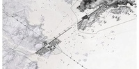
La expresión gráfica del plano de usos no ayuda a su comprensión en ningún momento. Creo que la elección de la gama de colores negro/gris para todos los usos no ha sido acertada, además parece un plano un poco vacío, no creo que una ciudad tenga tan pocos usos. La idea de propuesta, intentar unir lo que una gran autovía separa, me parece genial. Sin embargo en los planos explicativos no se entiende que tipo intervención de las cuales habéis pensado vais a realizar, ni donde concretamente. Estaría bien localizar más la propuesta, buen trabajo!
